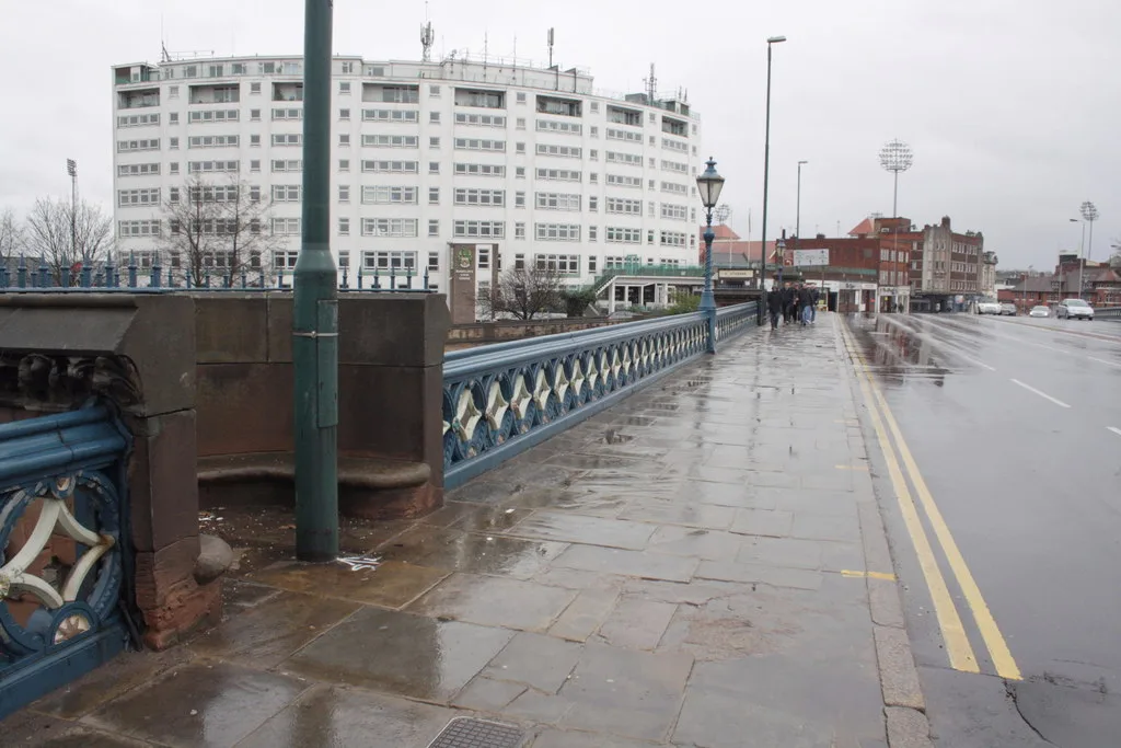

Gordon Road is shut northbound to 16 October, diverting Green 5, 6 and 12 buses. The A52 Gamston Link Road eastbound shuts 8pm 9 October to 6am 12 October.
Most roadworks pages go stale in a fortnight. This one is built the other way round: first the places to check what is actually shut this morning, then the structural facts about West Bridgford’s roads that will still be true next year, and only then the works currently in the diary.
Updated 5 October: Gordon Road is closed northbound from today until Friday 16 October for the Cadent gas works, and NCT has diverted the Green 5, 6 and 12 buses towards the city. The A60 Loughborough Road and Easthorpe Street closures in Ruddington have ended.
Updated 1 October: National Highways has added two more A52 closures at Wheatcroft, Flawforth Lane from 5 to 9 October and the A52 eastbound Gamston Link Road all weekend from 9 to 12 October. The Rectory Road gas order is now made, and new notices cover Rempstone and a Ratcliffe on Soar footpath.
The single most useful thing to know is that no one authority runs the roads here. Get that right and you will look in the correct place first time.
Where to check what is shut today
- one.network is the national roadworks map and the place to start. It carries county works, utility works and closures on the same map.
- Nottinghamshire County Council road maintenance is the highway authority page for almost every road in the borough, and the route into its Highways Hub for reporting a defect.
- nottshighways.co.uk carries the county’s own capital maintenance programme, run with its contractor Via East Midlands. This is where the month-ahead resurfacing schedule lives.
- National Highways travel updates covers the A52, A46, A453 and M1 only. County listings do not include them.
- Statutory notices are where closures are legally advertised, usually at least seven days ahead and often before they appear anywhere else. Search your street on the Public Notice Portal.
Who runs which road
This matters more than it sounds. If your journey is disrupted on the A52 at Nottingham Knight and you report it to Nottinghamshire County Council, you will get nowhere, because that junction belongs to National Highways.
The practical shape of West Bridgford is a town squeezed between a river and a trunk road. Two bridges carry it into Nottingham, Trent Bridge and Lady Bay Bridge, and both are county roads. To the south, the A52 runs the full width of the town as part of the strategic road network, with the A60 Loughborough Road and the A606 Melton Road joining it at the two junctions now being rebuilt.
That geometry is why a problem on either bridge or at either A52 junction is felt across the whole town within minutes. There is no third route.
The A52 junctions: Nottingham Knight and Wheatcroft
The largest piece of roadworks in West Bridgford is not a resurfacing job. It is a full rebuild of the town’s two A52 junctions, and it started in earnest on Monday 7 September 2026.
National Highways is converting the Nottingham Knight roundabout, where the A52 meets the A60, and the Wheatcroft roundabout, where it meets the A606, into through-abouts. In the authority’s own words, that means “you can travel straight through the junction instead of going around the roundabout”.
Its update dated 21 August 2026 has since gained two more October closures. As checked on 1 October, it sets out:
- From Monday 7 September, now under way: utility companies divert services at Wheatcroft, expected to take around three months, with lane closures and a 40mph limit on that stretch of the A52. That limit is the change most drivers in the town will notice, and on the authority’s own timing it is in place into December. The lane closures normally run Monday to Friday, but National Highways says they stay in continuously from Monday 21 September to Friday 2 October, including the weekend of 26 and 27 September, before returning to weekdays only.
- 6am Monday 5 October to 8pm Friday 9 October: a section of Flawforth Lane, where it joins the A52, is closed again. National Highways links the same diversion map as the September closure, via Kirk Lane, the A60 through Ruddington and the A52 from Nottingham Knight.
- 8pm Friday 9 October to 6am Monday 12 October: part of the A52 eastbound, Gamston Link Road, at Wheatcroft is closed. This time it is a continuous weekend closure, not overnight only. National Highways links the same diversion map as the September overnight closures, which brought traffic through the town, north along Melton Road and east along Radcliffe Road.
- Already done: Flawforth Lane was closed from 21 to 25 September, and the Gamston Link Road overnight on the nights of 25 to 28 September.
- From November 2026: utility work starts at Nottingham Knight, expected to last four months. Traffic management for it has not been published yet.
The end date has moved. National Highways now says “the overall scheme is expected to run from September 2026 until Spring 2029”. The summary panel at the top of the same page still reads “Start date 2017 End date 2027”. Both figures are live on the authority’s own page and it has published no explanation for the gap. Our report on the September works has the diversion maps and the full timetable. (National Highways)
The earlier stages, for the record:
- 8 July 2025: public inquiry into the Compulsory Purchase Order and Side Roads Order opens in Beeston.
- 13 November 2025: the Secretary of State for Transport confirms both Orders, as modified, clearing the way for construction.
- 23 February to 13 March 2026: advance work. Vegetation cleared from both roundabouts under overnight lane closures, 8pm to 6am, plus temporary fencing around the CPO land and a main works compound set up off the A52 between the two junctions.
- Early May 2026: five weeks of overnight surveys, with short lane closures.
Two practical points for residents. First, that compound sits between the junctions for the duration, so construction traffic on the A52 is a multi-year fact, not a one-off. Second, the works are on the trunk road, so nothing about them will appear on Nottinghamshire County Council’s roadworks listings. Check National Highways.
The county programme: Ruddington this week, Lady Bay Bridge still undated
Nottinghamshire County Council published its September 2026 programme on 4 September 2026. It lists 24 major resurfacing and machine-lay patching schemes for the month, part of a record £181.25 million Highway Capital Maintenance Programme, alongside surface dressing and micro asphalt work at more than 200 sites countywide.
What that means for this borough:
- A60 Loughborough Road and Mere Way roundabout, Ruddington: named as one of the county’s headline resurfacing schemes for September. The closure order is now made and runs to Saturday 3 October (see below).
- Gotham: listed for patching by the council’s JCB Pothole Pro machines, along with Widmerpool.
- Lady Bay Bridge: resurfacing and drainage improvements were announced in the August programme, but the bridge is not named anywhere in the September list, and the county has still published no start date. Treat it as pending, not cancelled.
- Carnarvon Road, West Bridgford: reopened. The closure order between Melton Road and Exchange Road expired on 31 August 2026 and has not been renewed.
Councillor Bert Bingham, cabinet member for transport and environment, said the council had “delivered nearly 100 road surface improvement schemes” by the end of July, and that “more than 150 roads across the county will be treated between now and autumn”. He also warned that schedules “can change due to weather conditions”. (Nottinghamshire County Council, 4 September 2026)
The county had not published an October programme in its newsroom when we checked on 1 October. The full schedule, updated as weather and operations shift it, is on the Notts Highways website. It is published as an embedded dashboard, so we cannot read individual street dates out of it.
Closures already advertised
Temporary closures are advertised as statutory notices before the cones appear. This list was checked on 1 October 2026 against every traffic notice published for West Bridgford and the Rushcliffe villages.
The biggest live order is in the town centre. Cadent Gas has a second mains replacement order, R26-237. The county confirmed on 28 September that it has been made, and from Monday 28 September to Friday 20 November it covers these streets:
- Rectory Road, closed to eastbound traffic between Exchange Road and Central Avenue
- Gordon Road, closed to northbound traffic for 70 metres south of Rectory Road; NCT gives this phase as Monday 5 to Friday 16 October
- Exchange Road, closed for 30 metres south of Rectory Road
- Albert Road and Violet Road, no waiting, loading or unloading at any time along their whole length
The signed diversions all run through Musters Road and Melton Road, with Burleigh Road and Clumber Road used for the one-way sections. Gordon Road also has one of the borough council’s three town-centre car parks, so check the signs before you drive in.
Buses (checked 5 October). NCT’s service updates list these changes for the town: (NCT, service updates)
- Gordon Road closure, Monday 5 to Friday 16 October. Gordon Road is shut to northbound traffic, so buses towards the city divert. Green 5 and 5A turn right at the end of Brockley Road onto Davies Road, then Radcliffe Road and Trent Bridge. Green 6 carries on along Stamford Road to Melton Road, Musters Road, Rectory Road and Central Avenue. Green 12, 12C and 12E stay on Radcliffe Road past Davies Road to Trent Bridge. NCT lists 12 stops as affected, including Brockley Road, Cyril Road, Davies Road, Tudor Square, Central Avenue Shops, the Co-op stop and Cricket Ground. Buses back from the city are not listed as changed.
- Green 7, 8 and 9 towards the city cannot serve the Central Avenue Shops stop from Monday 28 September to Friday 9 October. They run along Rectory Road and left onto Bridgford Road instead. Use the stop near the Co-op for the full Green line frequency.
- Green 9’s Eton Road daytime diversion, listed from 28 September, no longer appears in NCT’s updates.
- Green 11 and 11C to Lady Bay run via Arkwright Street, Meadows Way and London Road until the end of service on Friday 9 October, because the Arkwright Street and Bathley Street junction in the Meadows is closed. Buses back to the city are on their normal route.
- Ryehill Street stop in the Meadows, used by the Navy, Green and Pathfinder 90 buses towards Trent Bridge, is closed for roadworks. NCT says use the next stop, Victoria Embankment.
- Across the city centre, NCT warned on 29 September that demolition on Maid Marian Way has left the centre “severely congested”, with “severe delays and short notice cancellations” on all services. Allow extra time for any bus into town.
One more order was published for the villages on 21 September. Hawksworth Road, Scarrington Road, Main Road and Sibthorpe Road, between Scarrington, Hawksworth and Sibthorpe, close from Monday 5 October to Sunday 14 February 2027 (order intended, R26-239). (Public Notice Portal)
Other live and coming orders in the borough:
- Already ended: the A60 Loughborough Road closure at Ruddington and Bradmore (to Saturday 3 October) and the Easthorpe Street, Ruddington, drainage closure (to Friday 2 October). NCT no longer lists the Ruddington bus diversions. The Loughborough Road order’s text is kept below for its copying error.
- A60 Loughborough Road, Ruddington and Bradmore (ended): closed from Flawforth Lane to Asher Lane and on to Plumtree Lane, Monday 28 September to Saturday 3 October, for Via East Midlands resurfacing. The county named A60 Loughborough Road at Ruddington among its headline September schemes. The signed diversion is very long: out along the A52 and Melton Road to the A46, then back through Wymeswold, Rempstone, Costock and Bunny.
- West Bridgford Footpaths No.30 and No.31, Sharphill Woods: closed at the southern end of the wood, Monday 21 September to Friday 30 October, while ash trees with ash dieback are thinned. The county says there are alternative routes around the outside of the woods, though they are not public rights of way.
- Nottingham Road, Fairham: the six-month closure is no longer a proposal. The county published the made order on 15 September and it applies from 17 September 2026 to 17 March 2027.
- Wymeswold Road and Main Street, Rempstone, about 12 miles south of West Bridgford: closed from Main Street to Rempstone Road, Wymeswold, and from Wymeswold Road to the A60, Monday 12 to Saturday 17 October, for Via East Midlands resurfacing (order intended, R26-242). The signed diversion runs through Hoton, Cotes, Prestwold, Burton on the Wolds, the A46 and Wymeswold.
- Ratcliffe on Soar Footpath No.9, from the field entrance off Barton Lane to Thrumpton Footpath No.1: closed Thursday 1 October 2026 to Thursday 1 April 2027 for “pre extraction mining works”. An alternative route is provided around the field edge (order made 30 September).
The Loughborough Road notice carries a copying error. Its second clause bans waiting on “Angrave Road, East Leake” and “Roulstone Crescent, East Leake”, streets from a different order, and gives the Angrave Road stretch as running from Flawforth Lane to Asher Lane, which is in Ruddington. The closure itself is clearly worded; the waiting restrictions are not.
In Lady Bay, the first Cadent order, R26-205, is still under way until 23 December. Our report on the Lady Bay gas works has the street-by-street detail.
| Road | What | Dates | Why |
|---|---|---|---|
| Rectory Road (Exchange Road to Central Avenue, eastbound), Gordon Road (70 m south of Rectory Road, northbound) and Exchange Road (30 m south of Rectory Road), town centre | One-way closures on Rectory Road and Gordon Road, full closure of the Exchange Road stretch. Diversions via Musters Road, Melton Road, Burleigh Road and Clumber Road | Under way, Mon 28 Sep to Fri 20 Nov 2026 (order made, R26-237). Gordon Road northbound closed Mon 5 to Fri 16 Oct (NCT) | Cadent Gas mains replacement |
| Albert Road and Violet Road, town centre (whole length) | No waiting, loading or unloading at any time, both sides. Existing permanent restrictions suspended as required | Under way, Mon 28 Sep to Fri 20 Nov 2026 (order made, R26-237) | Cadent Gas mains replacement |
| Ropsley Crescent (whole length) and Seymour Road (from Trent Boulevard, 50 m south), Lady Bay | Roads closed. Diversions: Ropsley Crescent via Radcliffe Road; Seymour Road via Rutland Road, Julian Road and Trent Boulevard | Under way, to 23 Dec 2026 (order made, R26-205) | Cadent Gas mains replacement |
| Rutland Road (Oakfields Road to Julian Road), Gertrude Road, Trent Boulevard (Gertrude Road to Adbolton Lane), Adbolton Lane (50 m east of Trent Boulevard) and Pierrepont Road | No waiting, loading or unloading at any time, both sides. Existing permanent restrictions suspended as required | Under way, to 23 Dec 2026 (order made, R26-205) | Cadent Gas mains replacement |
| Lady Bay Bridge (both the West Bridgford and Nottingham halves) and all of Scarrington Road | Closed to traffic when signs are in place; signed diversion via Radcliffe Road, Trent Bridge, London Road, Fisher Gate, Pennyfoot Street, Manvers Street and Meadow Lane | Sat 22 Aug 2026 to Sun 23 May 2027 (order made, R26-194) | Nottingham Forest FC, public safety at City Ground events |
| A52 at Wheatcroft junction | Lane closures and a temporary 40mph limit | From Mon 7 Sep 2026, expected to last around three months (National Highways) | Utility diversions for the A52 junctions scheme |
| Flawforth Lane, where it joins the A52 at Wheatcroft | Road closed; signed diversion via Kirk Lane, the A60 through Ruddington and the A52 from Nottingham Knight | 6am Mon 5 Oct to 8pm Fri 9 Oct 2026 (National Highways) | Utility diversions for the A52 junctions scheme |
| A52 eastbound, Gamston Link Road, at Wheatcroft junction | Closed through the weekend; National Highways links the same diversion map as September, via Melton Road and Radcliffe Road through West Bridgford | 8pm Fri 9 Oct to 6am Mon 12 Oct 2026 (National Highways) | Utility diversions for the A52 junctions scheme |
| West Bridgford Footpaths No.30 and No.31, southern end of Sharphill Woods | Footpaths closed. Alternative routes around the outside of the woods, not on public rights of way | Mon 21 Sep to Fri 30 Oct 2026 (order intended) | Thinning ash trees affected by ash dieback |
| Kegworth Road, Ratcliffe on Soar and Kingston on Soar; The Green and Long Row, Kingston on Soar | Roads closed. Diversion via Gotham Road, West Leake Lane and the A453 | 8am Mon 7 Sep to 5pm Sun 13 Dec 2026 (order made, R26-180) | Severn Trent Water mains replacement |
| Angrave Road and Roulstone Crescent, East Leake | Both roads closed for their whole length, plus no waiting, loading or unloading at any time on both sides. The notice states no alternative route is available | Tue 1 Sep to Fri 6 Nov 2026 (order made, R26-204) | Via East Midlands footway resurfacing |
| Kirk Hill and East Bridgford Road, at the A6097 junction | Both roads closed; diversion via Fosse Way, Butt Lane and Main Street, plus a temporary speed restriction on the A6097 | From Mon 24 Aug 2026, stated as 12 months | Nottinghamshire County Council, A6097 junction rebuild |
| Brunts Lane, East Bridgford (East Bridgford Restricted Byway 34), entire length | Road closed. The notice states no alternative route is available | 00:01 Wed 9 Sep 2026 to 23:59 Tue 24 Aug 2027 (order intended, R26-226) | Via East Midlands junction improvement works |
| Granby Lane, Bingham, from the A52 Grantham Road for 50 m south | Road closed; diversion via Granby Lane and Bingham Road to Granby, Granby Hill, Main Street, Sutton Lane, Redmile Lane and the A52 through Whatton and Aslockton | 8pm Mon 14 Sep to 6am Sun 4 Oct 2026 (order intended, R26-211) | Severn Trent Water mains replacement |
| Wymeswold Road and Main Street, Rempstone | Roads closed, plus no waiting, loading or unloading on both sides. Diversion via Hoton, Cotes, Prestwold, Burton on the Wolds, the A46 and Wymeswold | Mon 12 Oct to Sat 17 Oct 2026 (order intended, R26-242) | Via East Midlands carriageway resurfacing |
| Ratcliffe on Soar Footpath No.9, Barton Lane field entrance to Thrumpton Footpath No.1 | Footpath closed; alternative route around the field edge | Thu 1 Oct 2026 to Thu 1 Apr 2027 (order made) | Pre extraction mining works |
| Nottingham Road, Fairham, from its northern junction with Fairham Way to Barton Lane | Road closed; diversion via Nottingham Road and Fairham Way | Thu 17 Sep 2026 to Wed 17 Mar 2027 (order made, R26-225) | Fairham Pastures Developments Ltd, road maintenance |
| Bingham Footpath No.3, at the footbridge from Moorbridge Road East to Archers Lake | Footpath closed. The notice states there is no direct alternative route on public rights of way | Mon 14 Sep to Mon 5 Oct 2026 (order intended) | Footbridge maintenance |
| Holme Pierrepont Footpath No.2, first footbridge to Radcliffe Road | Footpath closed. The notice states there is no alternative route for pedestrians on public rights of way | Continued to 16 Aug 2027, or until the works finish | Repairs to timber footbridges |
Two notes on the Cadent order. The county’s published notice misspells two of the streets, printing “Gertude Road” and “Abbolton Lane” for Gertrude Road and Adbolton Lane. It also gives the dates as “Tuesday 31st August” and “Friday 23rd December”, but in 2026 those fall on a Monday and a Wednesday. The dates are what count. And like every temporary order, the restrictions “shall only be in effect when the signs are in place”, so the 31 August to 23 December window is the period Cadent is allowed to work in, not a promise that every street is dug up for all of it. The order also carries the standard clause letting it run on “within a maximum period of 18 months” if the work is not finished.
The same “intended” and “made” distinction matters across the whole table. An order at the intention stage means the county has said it will make it but has not yet done so. That covers the Easthorpe Street, Sharphill Woods and Rempstone closures and, when we last saw their notices, Brunts Lane, Granby Lane and the Bingham footpath. The town-centre gas order and the A60 Loughborough Road closure were both confirmed as made on 28 September. The rest have been made.
The Kirk Hill closure is the biggest thing happening on the borough’s roads this year, and it takes the rushcliffe villager off Shelford and Gunthorpe from the same day. Brunts Lane, which the earlier notice said would stay shut, now has an order of its own running to 24 August 2027. Nottinghamshire County Council now says the junction will be finished “next autumn”. Our report on the Kirk Hill works has the phases, the bus changes and the replacement 747.
The Lady Bay Bridge matchday order is no longer a proposal. It was advertised as an intention on 10 August and the county confirmed on 20 August that it has now been made, covering the whole 2026/27 football season; our report on the matchday closures has the diversion route and the first fixtures. (Cadent works, R26-205, Lady Bay Bridge, Kegworth Road and Kingston on Soar, R26-180, Angrave Road and Roulstone Crescent, R26-204, Brunts Lane, R26-226, Granby Lane, R26-211, Nottingham Road, Fairham, R26-225, Bingham Footpath No.3, Holme Pierrepont Footpath No.2, town centre gas works, R26-237, A60 Loughborough Road, R26-233 and made order, town centre gas works, made order, Rempstone, R26-242, Ratcliffe on Soar Footpath No.9, Easthorpe Street, R26-235, Sharphill Woods footpaths, Nottingham Road, Fairham, made order)
One permanent change was made in August. Greythorn Drive now has double yellow lines on its northeast side from 12 metres southeast of Rugby Road to 135 metres north of Stowe Avenue, and on the southwest side for 7 metres from Rugby Road, “to prevent parking near the junction which is causing issues with visibility” (order 8425, advertised 3 August 2026). (Public Notice Portal)
A borough-wide administrative order, the Rushcliffe Borough Consolidation (Static Restrictions and Prohibitions) Traffic Regulation Order 2026, came into force on 3 August 2026. It merges the borough’s existing permanent parking and waiting orders into a single document. The council is explicit that “there are no changes to the effects of any of the individual Orders, as this is an administrative exercise only”, so nothing on the ground changes. (Public Notice Portal)
Two things we still could not confirm on 1 October. A seven-day closure of the A606 Melton Road for surface dressing was reported locally in September, and Melton Road surface dressing is in the county’s 2026/27 programme, but no statutory notice for it has appeared and the county’s surface dressing schedule is an embedded dashboard we cannot read. And the Lady Bay Bridge resurfacing and drainage job, announced in August, still has no published start date. We are carrying neither as confirmed rather than repeating someone else’s wording.
Just outside the borough, the county’s Lowdham roundabout rebuild on the A6097, about eight miles north east of West Bridgford and two miles from the Kirk Hill works, started on 20 September. NCT expects the works to last about 13 months. The council says temporary signals and reduced lanes will be in place on the approaches for months, with weekend closures of the A612 in October and November and Southwell Road closed from December 2026 to March 2027. (Nottinghamshire County Council, NCT)
New notices appear weekly. Search your own street on the Public Notice Portal rather than relying on this list being complete.
Parking: two sets of charges, two authorities
West Bridgford charges for both off-street and on-street parking in the same town centre, run by two different councils, and the two price lists diverge sharply.
- Rushcliffe Borough Council car parks (Bridgford Road, Gordon Road, Nursery): £1.20 for an hour, £4.00 up to three hours, £30.00 over three hours. Free 8pm to 7am. Charges apply on bank holidays.
- Nottinghamshire County Council on-street bays, 8am to 8pm daily: free for 30 minutes but you still need a ticket, £1.50 for an hour, £3.50 for three, and £6.00 for a long stay on Bridgford Road, Fox Road or Hound Road.
For anything past three hours the on-street long-stay bays cost £6.00 against £30.00 in a car park. That single step is the most expensive mistake a driver can make in the town.
Every tariff for every Rushcliffe car park, the free two-hour vouchers at Bingham and Keyworth, permits, Blue Badge rules and penalty charges are on our parking page.
Match days
The City Ground and Trent Bridge sit side by side at the north end of the town, next to the two river crossings, and a Nottingham Forest home fixture or an international at the cricket ground fills every approach road. Nottingham City Council’s own advice on a busy August fixture was blunt: local roads are likely to be busy and public transport is the better option. (Nottingham City Council travel bulletin)
Rushcliffe’s Planning Committee resolved on 16 September 2026 to approve Forest’s plans to expand the ground. No extra spectators are allowed until a scheme to move crowds across the river has been approved and built, so match-day traffic here does not change yet; our report on the decision explains the conditions.
For 2026/27 the county has made a season-long order closing Lady Bay Bridge and Scarrington Road when signs are in place around City Ground events, from 22 August 2026 to 23 May 2027, with a diversion over Trent Bridge and London Road. Details are in the table above and in our report. The streets on the Lady Bay side of that bridge are now inside the Cadent gas works area as well, so parking there is tighter on match days than it was last season. Temporary closures around the ground are advertised as statutory orders, so the Public Notice Portal is where to check before a fixture. And if you are visiting the ground rather than watching a match, Nottingham Forest directs stadium tour visitors to free parking in the Brian Clough Car Park off Lady Bay Bridge Road (NG2 5FA), about ten minutes’ walk from the Megastore. (Nottingham Forest)
Park and ride
There is no park and ride site in West Bridgford. NET runs 5,000 free spaces across seven sites, and the nearest is Clifton South at the far end of the same tram line that serves the town. The others (Toton Lane, The Forest, Wilkinson Street, Phoenix Park, Moor Bridge and Hucknall) are all on the opposite side of the city. (NET)
For most West Bridgford addresses the tram stop is closer than any park and ride, so the sensible move into the city is to walk to Compton Acres, Ruddington Lane, Wilford Lane or Wilford Village. Full tram times and fares are on our trains to London page.
Frequently asked questions
Where can I check West Bridgford roadworks today?
Start with one.network, which shows county and utility works on one map. For the A52, A46, A453 and M1, check National Highways instead, because county maps do not cover trunk roads.
Who is responsible for the A52 through West Bridgford?
National Highways. The A52, A46, A453 and M1 are all part of the strategic road network. Nottinghamshire County Council is the highway authority for Trent Bridge, Lady Bay Bridge, the A60, the A606, Radcliffe Road and every residential street.
What is happening at Nottingham Knight roundabout?
National Highways is rebuilding it, and the Wheatcroft roundabout on the A606, as through-abouts so traffic can pass straight through rather than round. The Compulsory Purchase Order was confirmed on 13 November 2025 and advance work ran through 2026. Utility diversions began at Wheatcroft on 7 September 2026, with a 40mph limit and lane closures expected to last around three months, and start at Nottingham Knight in November 2026. National Highways’ latest update says the whole scheme runs “from September 2026 until Spring 2029”, although the summary at the top of its own scheme page still gives an end date of 2027.
How much is parking in West Bridgford?
In the Rushcliffe Borough Council car parks on Bridgford Road, Gordon Road and Nursery it is £1.20 for an hour, £4.00 for three hours and £30.00 for anything over three hours, free between 8pm and 7am. On-street it is free for 30 minutes with a ticket, £1.50 for an hour and £3.50 for three hours, with long-stay bays on Bridgford Road, Fox Road and Hound Road at £6.00 for over four hours. Full tariffs for every car park in the borough are on our parking page.
Is there a park and ride for West Bridgford?
No. The nearest NET park and ride is Clifton South, at the far end of tram Line 2. For most of the town the tram stop is closer than the park and ride.
When did on-street parking charges start in West Bridgford?
Monday 31 March 2025. Eleven town-centre streets are in the scheme, charged 8am to 8pm every day, with the first 30 minutes free but still requiring a ticket.
Related
- West Bridgford to London by train: tram times, fares and why the eastern villages should use Grantham.
- A52 Wheatcroft works start on 7 September: the dated closures, the diversion routes and the 2029 end date.
- Lady Bay gas works, 31 August to 23 December: the seven streets in the order and what each one loses.
- City Ground expansion approved: what the 16 September decision means for Trent Bridge, parking and match days.
- West Bridgford planning news: the borough’s biggest applications and its housing target.
- Things to do in West Bridgford, with parking notes for each venue.
- Parking in West Bridgford, every tariff, permit and penalty charge.
- West Bridgford bin days, and the bank holiday changes.
Sources
- One.Network, Nottinghamshire County Council road maintenance, Notts Highways and National Highways travel updates for live works.
- National Highways, A52 Nottingham junctions for the Nottingham Knight and Wheatcroft scheme, its Orders and its timetable.
- NCT service updates for the bus diversions and stop closures.
- Nottinghamshire County Council, highways update, 4 September 2026 for the £181.25m programme, the 24 September schemes and the A60 Loughborough Road work at Ruddington.
- Public Notice Portal for the Cadent gas works order R26-205, Lady Bay Bridge, Kegworth Road and Kingston on Soar R26-180, Angrave Road and Roulstone Crescent R26-204, Brunts Lane R26-226, Granby Lane R26-211, Nottingham Road, Fairham R26-225, town centre gas works R26-237, A60 Loughborough Road R26-233, Easthorpe Street R26-235, Sharphill Woods footpaths, Bingham Footpath No.3, Holme Pierrepont Footpath No.2, Rempstone R26-242, Ratcliffe on Soar Footpath No.9 and Greythorn Drive orders, and the Rushcliffe consolidation order.
- Rushcliffe Borough Council car parking fees and charges and Nottinghamshire County Council West Bridgford on-street parking review for the tariffs.
- NET park and ride for the seven park and ride sites.
Last checked 1 October 2026. Dated closures can move. Check the live maps above before you travel, and check the tariff board in the car park before you assume a price.
Have your say