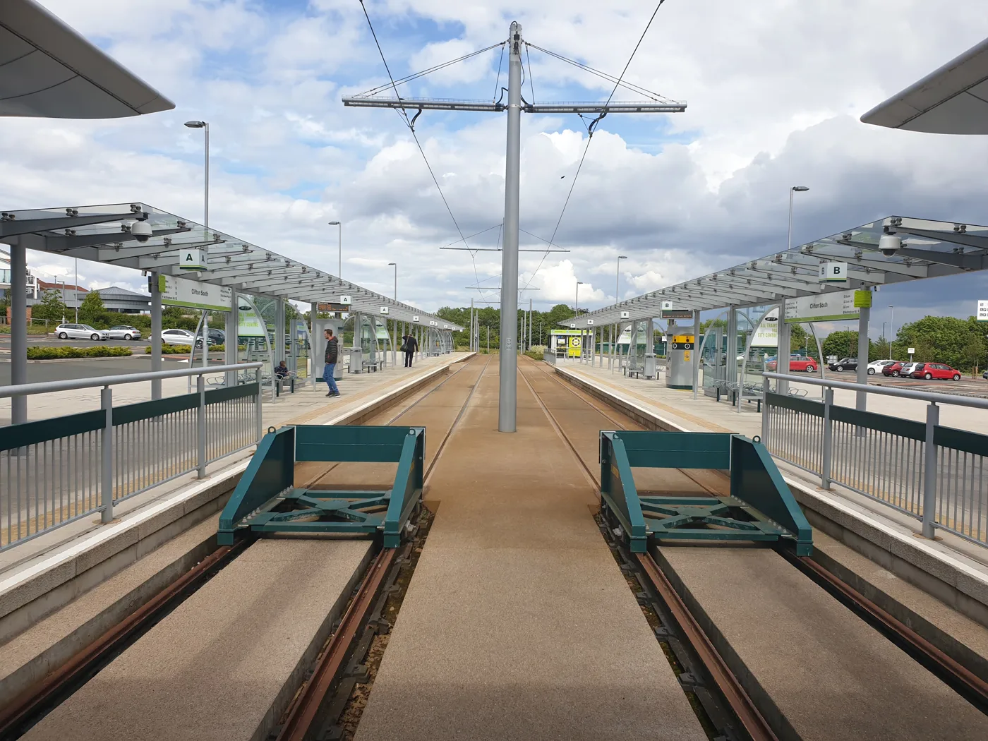

Residents wore a path across the grass to the Clifton South tram. Now Fairham's developers want to pave it: 3.5m of asphalt, tactile paving and 92 shrubs.
People moving into the new Fairham development have worn a track across the grass to the Clifton South tram stop. The developers now want to pave it.
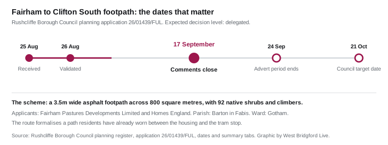
A full planning application to build a surfaced footpath between Fairham Way and the Nottingham Express Transit park and ride was validated by Rushcliffe Borough Council on 26 August. Comments close on Thursday 17 September.
The applicants are Fairham Pastures Developments Limited and Homes England. The reference is 26/01439/FUL, and the site sits in Barton in Fabis parish, in the Gotham ward, roughly four miles south west of West Bridgford.
The path residents made first
The reason this application exists is unusual, and the applicants say so plainly.
Outline permission for the scheme then called Clifton South, now Fairham, was granted in May 2019 under reference 14/01417/OUT. Homes have since been occupied on the first residential phase. As people moved in, they started walking to the tram.
“As occupation has increased, a desire line has become established between the Fairham development and the NET Clifton South Park and Ride,” the applicants’ agent wrote to the council on 24 August. The park and ride sits immediately to the north east of the new housing.
The applicants’ own planning, design and access statement is blunt about what that informal route is missing. It has no formal surfacing, no inclusive access features, no defined crossing, and no year-round usability. It “can become difficult to use during periods of poor weather”.
The statement also concedes that nobody is making them do this. Fairham “already benefits from suitable access arrangements to the Park and Ride and there is no requirement to provide additional connectivity”. The applicants say they are formalising the route because it is already being used.
What would be built
The application covers about 800 square metres, or 0.08 hectares, a narrow corridor between the housing and the tram stop. The proposal includes:
- a new asphalt footpath, 3.5 metres wide, with a 0.5 metre margin either side
- a new pedestrian crossing point with buff tactile blister paving, at least three rows deep
- dropped kerbs and tactile paving along the route
- regrading of the existing earth bund either side of the path, to a maximum slope of one in three
- two bollards
- connections into the existing footways at both ends
The engineering drawing by Jackson Consulting Engineers specifies a 25mm surface course over a 90mm binder course, on a sub-base of at least 225mm.
Landscaping is a bigger part of the scheme than the size suggests. The shrub schedule lists 92 native shrubs and climbers, planted at one metre centres as a woodland edge mix. Hazel dominates with 40 plants. There are nine each of hawthorn, dog rose and alder buckthorn, and five each of holly, wild privet, honeysuckle, guelder rose and traveller’s joy. Wildflower and grass seeding is proposed alongside.
Because the site is under 0.1 hectares and holds no priority habitat, the scheme falls inside the small sites exemption from biodiversity net gain. The applicants say the new planting will add ecological value anyway.
What the drawing warns the contractor about
The general arrangement drawing carries a residual risk panel, the standard construction-regulations warning to whoever ends up building it. Three things are flagged on this site: contaminated ground conditions, overhead cables, and “possible asbestos containing material present on site”, which the drawing says must not be disturbed and should be removed by a specialist or encapsulated before work starts.
The drawing also tells the contractor to note the close proximity of the A453 to the north and a private access road to the south.
What it means for you
If you use the Clifton South park and ride, this is the stop at the far end of the proposed path, and nothing about the tram service changes.
If you want to comment, you have until Thursday 17 September. Comments go through the application page on the council’s planning portal. The advertisement period runs a week longer, to 24 September.
The council does not expect this one to go to committee. The register records the expected decision level as delegated, meaning a planning officer decides it, and gives an internal target date of 21 October. The case officer is Russell Williams.
We track new applications across the borough on our West Bridgford planning news page, and current closures and travel disruption on the roadworks and travel page.
Have your say