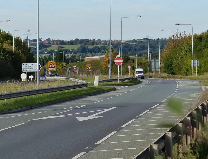

National Highways has told Rushcliffe not to approve the 2,250-home Gamston plan for three months. The county has dropped its flood objection.
National Highways has told Rushcliffe Borough Council not to approve the plan for 2,250 homes east of Gamston for three months. It wants more traffic evidence from the developers first.
Its formal recommendation is dated 13 October. On the same day, Nottinghamshire County Council’s flood team withdrew the objection we reported on 12 October. Active Travel England has since said it is “not currently in a position to support” the scheme either.
The application is 20/03244/OUT, an outline plan by Taylor Wimpey UK and Rockspring Barwood Gamston Limited. It covers up to 2,250 homes, a primary school and a local centre on farmland east of Gamston and north of Tollerton. Every document quoted below is on its Documents tab; some links only open after you have visited the application page.
What National Highways wants
National Highways runs the A52, so it is a statutory consultee on anything that adds traffic to it. Its assessment recommends deferral, the option for withholding permission for a set period. The reason, in its own words: “It is recommended that the application should not be approved for a period of three months to allow the applicant to provide further information for our review.” (National Highways response, 13 October 2026)
The three months run from 13 October, so to the middle of January.
That carries weight. If the council wanted to decide against the recommendation, it would first have to consult the Secretary of State for Transport and wait for that process to finish.
The points it raises:
- A new A52 junction south of the site needs Government approval in principle. It wants a “Strategic Business Case” showing the growth cannot be handled by upgrading existing junctions, and says this must come from the Department for Transport “prior to any part of the allocation being approved”.
- A park and ride north of the Gamston roundabout appears only in the developers’ “mitigation” traffic model. National Highways says that if it is a separate scheme, it must be in every scenario, or the test of the developers’ own fixes means nothing.
- School traffic was miscounted. It says car trip rates for the school were “misinterpreted as personal trips” in one appendix, and asks for the right figures.
- More queue and journey time results, including the morning and evening comparisons the report left out.
The road changes in the plan
The joint transport assessment, dated August 2026, sets out three ways into the wider Gamston site:
- a new signalised four-arm roundabout replacing the A52 junction at Ambleside
- traffic lights at the existing A52 and Tollerton Lane junction
- a new signalised T-junction further south, eventually linking to Tollerton Lane
National Highways says it has “no objections in principle” to the access arrangements across the A52. It still wants more detail on the three design options for the walking and cycling bridge over the A52, including the benefits and drawbacks of each.
It also points out that the traffic model assumes far more than the 2,250 homes in this application. The three live applications for the area total 3,180 homes:
| Application | Developer | What it proposes |
|---|---|---|
| 20/03244/OUT | Taylor Wimpey and Barwood Land | 2,250 homes, a primary school, a local centre |
| 24/00347/HYBRID | Vistry Group | 380 homes, a primary school, a neighbourhood centre |
| 26/00512/SCOEIA | Nottinghamshire County Council | 550 homes, 12 hectares of employment land, a secondary school |
The model tests 4,400 homes, two primary schools, a secondary school, two local centres and the 12 hectares of employment land.
Developers on big Rushcliffe sites also pay a fixed sum per home towards the A52 Nottingham Junctions scheme under an agreement between National Highways, the county and the borough. That is the scheme now under way at Wheatcroft and Nottingham Knight.
The flood objection has gone
On 25 September the county’s flood team, the Lead Local Flood Authority, recommended refusal. On 8 October the developers’ drainage consultants, PJA, wrote to it point by point. They said the latest flood risk assessment already answered each concern. (Correspondence with the LLFA, 13 October 2026)
The flood team replied on 13 October, attaching “the removal of our objection and recommended conditions”. Its updated letter now says it has “no objection to the proposals and can recommend approval” subject to one long condition. Before any building starts, a detailed surface water scheme must be approved. It has to: (LLFA updated response, 13 October 2026)
- hold water back at several points across the site, not in one pond at the outfall
- stop the first 5mm of most rainfall running off the site at all
- keep run-off from a 1 in 100 year storm, plus 40% for climate change, to QBar, a greenfield run-off rate
- show no flooding in a 1 in 30 year storm, and keep anything worse inside the site without flooding homes
- show how water will be managed during construction and maintained for the life of the development
Who else has responded since 12 October
| Consultee | Date | Position |
|---|---|---|
| National Highways | 13 Oct | Do not approve for three months |
| County flood team (LLFA) | 13 Oct | Objection withdrawn; approve with a drainage condition |
| Canal and River Trust | 15 Oct | Concerns about two of its culverts |
| Active Travel England | 15 Oct | “Deferral”: not currently able to support |
| Historic England | 16 Oct | Refers to its December 2024 advice |
The Canal and River Trust says surface water would drain through culverts 55 and 56, both its own structures, under the Grantham Canal. It has “concerns over the ability of both” to take more flow. If they need upgrading, it says “the full cost of these works must be borne by the developer”. (Canal and River Trust, 15 October 2026)
Active Travel England welcomes the bridge but says the work on walking and cycling to places outside the site is weaker. It wants the bridge placed on the routes people will actually use, with fewer switchbacks. (Active Travel England, 15 October 2026)
Historic England asks that a conservation management plan for the site’s listed pillboxes is secured the same way across all the Gamston applications. (Historic England, 19 October 2026)
Sport England’s position, reported on 12 October, has not changed on the record: it still cannot support the scheme.
What it means for you
- No decision is close. National Highways has asked for a hold to the middle of January, and Active Travel England wants more work too. The application’s dates tab gives 3 November as the standard consultation expiry date.
- If you drive the A52 at Gamston, the junction changes above are the ones being tested: lights at Tollerton Lane, a roundabout at Ambleside and a new junction further south.
- If you live near the Grantham Canal at Bassingfield or Tollerton, the drainage route under the canal is now a named issue on the file.
- You can still comment on the application page. Comments go to the planning officer handling the case.
For the bridge plans and the three A52 footpath crossings that would close, see our 12 October report. Every planning story we cover is listed on our West Bridgford planning news page.
Sources
- Rushcliffe Borough Council, application 20/03244/OUT: documents and dates tabs, read 26 October 2026
- National Highways formal recommendation NH/25/09819, 13 October 2026
- Nottinghamshire County Council (LLFA), updated response and correspondence, 13 October 2026
- Canal and River Trust, 15 October 2026; Active Travel England, 15 October 2026; Historic England, 16 and 19 October 2026
Have your say